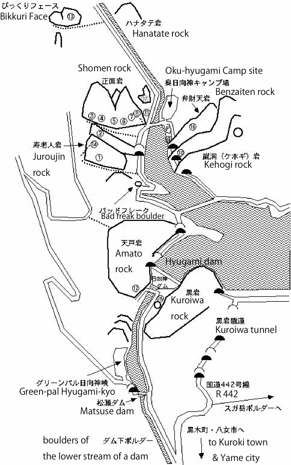
Hyugami

The circumference of Hyugami Shoumen rock is seen from the summit of Amato rock.


£±¡¤Ai(Love) no area
£²¡¤Kohan(Lakeside) no area
£³¡¤Okuheki(A back wall) area
£´¡¤Summertime area
£µ¡¤Competition area
£¶¡¤Bacher area
£·¡¤Balcony2 area
£¸¡¤Balcony area
£¹¡¤Training area
10¡¢Tunnel area
11¡¢Riverside area
12¡¢The lower stream of a dam area
13¡¢Bikkuri Face
14¡¢Juroujin area
15¡¢Tettoh(Steel tower) area
16¡¢Sunset area
17¡¢Michibata(Roadside) area


Hyugami area map (PDF file)


Approach to The lower stream of a dam area

Approach to Kuroiwa area (Now, the climbing is not performed for afforestation. )

Description by Mr. Shinbaru (IWA TO YUKI 1993)

Hyugami ravine is an andesite zone over Yabe village and Kuroki town. Many multi-pitch routes exist. January 3, 1989, 'Showa 5.11a' was cultivated by Mr. Shinbaru and exploitation of the short routes was advanced.

'Patriot 5.12a/b' in Balcony2 area (The climber is Mr.Mahara)


Benzaiten rock is seen from Ai(Love) no area.


Back|

Top page|